cbrfc title nws icon


Rivers
 0-14 days
 Text Products
 Peak Flows
 Recreational Forecasts
 5 Day Flood Outlook
 Hydro Data
 AHPS

Reservoirs
 0-14 days

Current Conditions
 Snow
 Snow Groups
 Precipitation
 Temperature
 Freezing Level
 Soil Moisture
 Radar
 Satellite

Water Supply
 Map
 Current Publication
 Weekly ESP
 Publication Archive
 Documentation
 Westwide
 Precipitation
 Temperature
 Soil Moisture
 Verification
 Western Water Supply
 Maps

Climate
 Hydroclimatology

Seasonal Information
 Data and Indicies
 Forecasts
 El Nino and MJO

CBRFC Office
 Information
 Contact Us
 Papers and Presentations
 Podcasts

Links
 NWS Offices
 Other Links


usagov icon
Significant River Flood Outlook
This Flood Outlook is intended to provide a general outlook for significant river flooding. It is not intended to depict all small-scale events such as localized flooding and/or flash flooding. This graphic will not depict minor river flooding as this implies only minimal or no property damage with possibly some public inconvenience. For official text forecasts, visit the Forecasts/Products section.
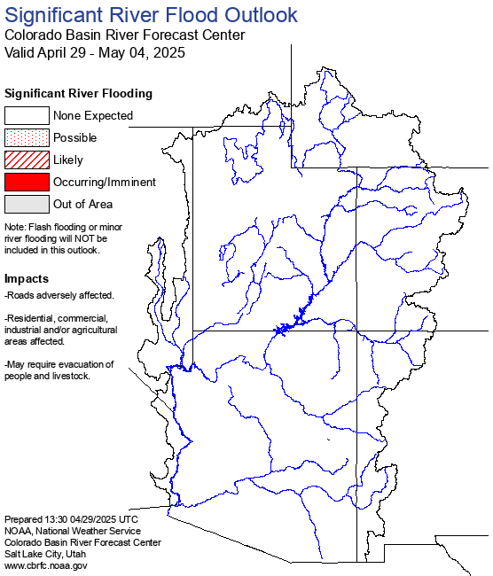
See National Product for outlook outside our area.

Definitions
Possible: Hydrometeorological conditions indicate that significant flooding could occur. Such flooding is neither certain nor imminent.
Likely: Hydrometeorological conditions indicate that significant flooding can be expected during the outlook period.
Occurring/Imminent: Significant flooding is already occurring or is forecast to occur during the outlook period.


Webmaster
US Dept of Commerce
National Atmospheric and Oceanic Administration
National Weather Service
Colorado Basin River Forecast Center (CBRFC)
2242 W North Temple
Salt Lake City, UT 84116
801-524-5130

Disclaimer
Information Quality
Credits
Glossary

Privacy Policy
Freedom of Information Act (FOIA)
About Us
Career Opportunities
Level Change