-Snow Water Equivalent & Precipitation...
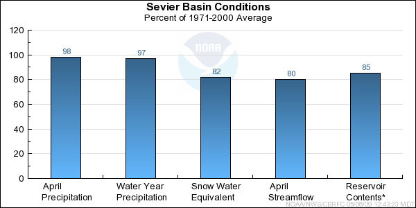
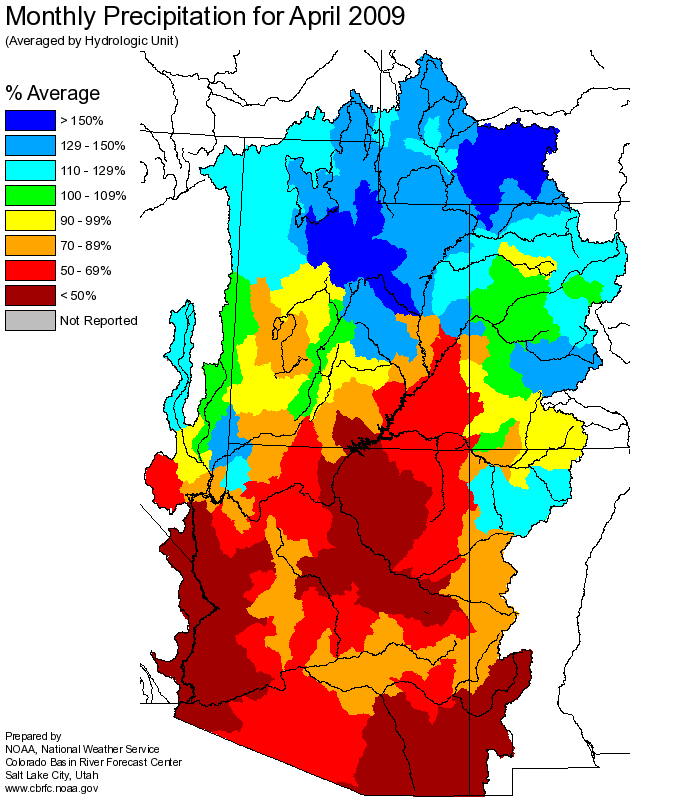
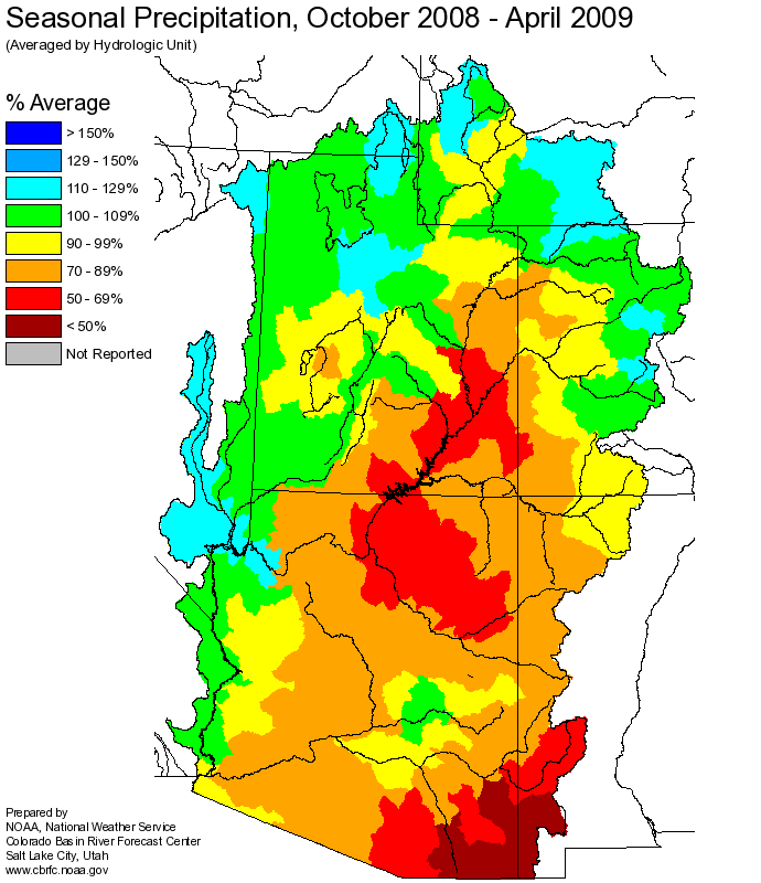
April weather conditions were near normal, yielding average precipitation and snowfall for the month. Monthly precipitation was 98% of average and seasonal numbers are now 97% of average.
Snow water equivalents values indexed for the basin are 81% of average. Only high elevation snows are left in the Sevier such as in the Tushars, along the
Wasatch Plateau and near Panguich Lake.
-Soil Moisture & Streamflow...
Streamflows last month were 83% of average for the Sevier River at Hatch. Estimates for the Sevier at Kingston show 78% of average flows. Flows are
currently increasing, as expected for May and we should see peak streamflows during the later half of May.
-Short Term Weather Guidance...Weather guidance from
National Weather Service Meteorological Models
show mostly average temperature and precipitation conditions during the first 6-10 days of May. Flow is currently zonal which will bring seasonal
temperatures, which moderate conditions helping to slowly, instead of quickly, melt the snowpack.
Short term
CPC guidance shows a slight shift to warmer and dryer
conditions for the second half of May which will accelerate the melt of snowpacks.
-General Discussions...
Longer range predictions from NOAA's Climate Prediction Center are now factoring in a weak
La Nina
episode, predicted to last through the spring of 2009. Please reference the web link above
for further details and effects within the Sevier River Basin.
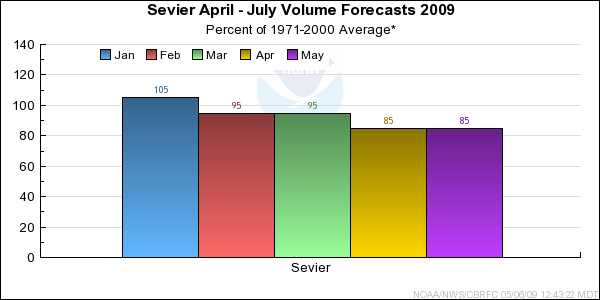
May through July volume forecast for the Sevier River ranged from 67% to 117% of average. The median forecast for the Sevier River Basin, May through July is 87% of average.
April through July forecast were calculated using observed or estimated streamflows for April. The current April through July forecast now ranges from 67% to 119% and the median
forecast is 83% of average.
Differences between the full period forecasts and the residual forecasts may not exactly equal the actual observed volumes due to rounding conventions (see Definitions section).