San Juan Water Supply Outlook, February 1, 2008
Note: This publication is scheduled for revision. If you have feedback on content, format, or publication frequency, please contact us.
Contents
San Juan Summary
Last month's streamflows were average to above average across the San Juan Basin. Some
notables were Vallecito inflow of 125% and San Juan near Bluff with 135%. Last month's
precipitation was much above average with 210%. The seasonal precipitation was above
average with 130%. The snowpack across the entire basin as of February 1st increased
from 130% to 155% of average. On February 1st, snowpack in the Upper San Juan Basin was
particularly high with 170% of average while the Animas Basin was 150%. The storm
totals from February 1st through the 4th was factored into the streamflow forecast.
Northwest flow will continue across the San Juan Basin into early next week with most
of the moisture forecast to stay north. The streamflow forecast was increased
for all of the forecast points this month due to the increase in snowpack over the
entire San Juan Basin.
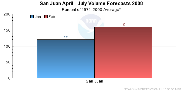
*Median of forecasts within each basin.
San Juan Basin Conditions
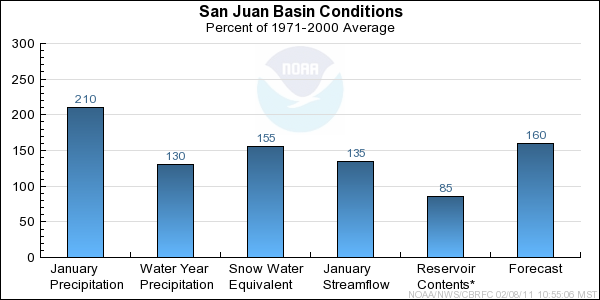
* Percent usable capacity, not percent average contents.
Click for multi-month Graph.
Differences between the full period forecasts and the residual forecasts may not exactly equal the actual observed volumes due to rounding conventions (see Definitions section).
Precipitation Maps


Hydrologist: Cox
